How do snowflakes form—and why do they have six sides?
Discover how snowflakes form, why ice crystals grow in six directions and how clouds shape them. Includes graupel, snow above freezing and a magnifying-glass activity.
A white speck lands on your sleeve. Through a magnifying glass it might become a branching star, a tiny plate or an untidy cluster. Snowflakes form from ice crystals in clouds. Their common sixfold structure comes from the arrangement of water molecules in ice; temperature, moisture and the journey through the cloud shape the details.
It helps to separate three questions: How does a crystal start? Why does it grow in particular directions? And what happens before it reaches the ground?
From cloud water to an ice crystal
A cloud can contain tiny liquid droplets, ice crystals or both. Droplets may remain liquid below 0°C; these are supercooled droplets. The visible cloud is not simply gaseous water vapor. Our guide to how clouds form explains that distinction.
One way a snow crystal begins is when a droplet freezes on a suitable tiny particle. NOAA gives dust and pollen as examples. Once an ice crystal exists, water molecules from the surrounding vapor can deposit directly onto its surface when conditions allow. The crystal grows.
Snow is not simply rain that freezes during the final part of its fall. The characteristic growth of a snow crystal takes place in the cloud. Freezing drops and growing snow crystals are different formation processes.
Why six sides rather than five or eight?
In ordinary atmospheric ice, water molecules form a crystal structure with hexagonal, or sixfold, order. That microscopic arrangement influences the directions in which the larger crystal can grow. It can produce six-sided plates and stars with six main arms.
The arms are not assembled separately from a blueprint. They grow on the same crystal, at the same time, in almost the same temperature and moisture conditions. That helps explain their similar branching patterns. Small differences, collisions and broken tips can still disrupt the symmetry.
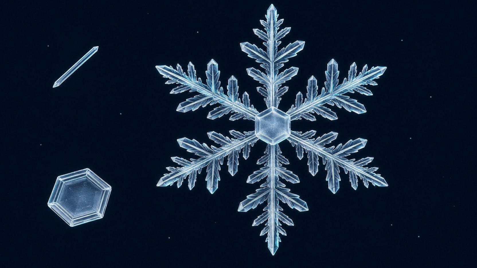
The cover is an editorial illustration, not a micrograph: a branching sixfold crystal alongside a simple plate and a needle. Real snow does not consist only of neat stars like the large example.
Temperature and moisture change the shape
Water molecules do not attach equally quickly to every crystal face. Temperature and the available water vapor affect which faces grow faster. The result can be a flat plate, an elongated column or needle, or a highly branched star. NOAA describes how growth conditions build on the underlying crystal structure.
As a crystal enters a different part of a cloud, its growth can change. New side branches may develop along existing arms. The final shape reflects a history of growth, rather than one temperature reading.
Individual crystals take different routes, which makes complex snow crystals remarkably varied. There is no need to turn this into an absolute claim that two matching crystals are impossible. The useful idea is that small differences during growth can produce large differences in shape.
Crystal, cluster or graupel?
“Snowflake” can mean more than one thing. The National Snow and Ice Data Center distinguishes single crystals, crystal clusters and graupel.
| What you see | A possible explanation |
|---|---|
| A delicate star or small plate | One clearly recognizable snow crystal |
| A large, loose flake | Several crystals stuck together |
| A rounded white pellet | Possibly graupel: supercooled cloud droplets have frozen onto a crystal |
| Irregular fragments | Crystals can collide, break or partly melt |
A big flake need not be one enormous star. Nor is every white pellet hail: graupel is generally softer and more crumbly.
Why can snow fall when it is above freezing?
The temperature outside your window describes only the bottom of the journey. Whether snow survives depends on the temperature and moisture profile through the air below the cloud. Crystals may melt in a warmer layer. If that layer is shallow enough, or cooling from melting and evaporation is sufficient, flakes can still reach the ground.
So “above 0°C means rain” is not a universal rule. Equally, frost at ground level does not create snowfall by itself: moisture and suitable formation conditions are needed higher up. One flake cannot substitute for a local forecast.
Try a simple magnifying-glass observation
When snow is falling, put a dark surface outside beforehand to cool it. Catch a few flakes and examine them promptly with a magnifying glass or macro camera before they melt.
- Look for individual shapes, rather than the perfect star.
- Count the main arms or corners of clearly visible crystals.
- Separate a single crystal from a loose cluster.
- Note broken tips, frozen droplets or melting edges without trying to reconstruct an exact cloud temperature.
For the wider geographical setting, search for the Alps in LiveGlobe 3D, then rotate and zoom the globe. Where do the mountains sit relative to seas and continents? The web app requires a sign-in, and place search relies on external data. The crystal itself is something to examine on your dark surface.
The six directions come from the structure of ice. The variety develops during the journey through the atmosphere. Keeping those ideas separate turns a white speck into a small record of growth.
Short clips
The app in motion: short, genuine glimpses straight from use.
At a glance
How the app feels on your phone.